Archive for Travel

Ride the RailTrails


“Excuse me, señora, could you tell us where the Carrilet is?

Without saying a word, the elderly woman pointed behind us. We turned, and rather embarassed, recognized the stone foundations of a railway bridge right behind us. No roadbed on top, but the foundations were definitely there.


Really, we should have seen it. But that was 1993, our second day of biking an old railbed only partially converted to a bike track and we hadn’t developed the skills that would guide us later on. One thing quickly learned: when in doubt, it was best to ask someone older. Many would remember when the railroad was still in use.

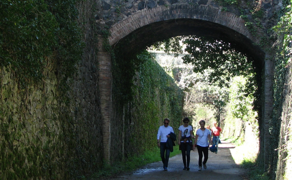
Losing train service is bad news for a town, but now the old railbeds have an alternative use for walking or biking, a use that has gone from marginal to mainline in a very short time, often bringing employment and eco-friendly development to rural areas. Most of these trails are used by locals of all ages – grampa walking for health, ladies out for a Sunday stroll, joggers, kids learning to ride bikes – as well as visitors exploring on foot, by bike or on horseback.

Before thinking “not for me” please read on a bit. Spain’s Vias Verdes have something for just about everyone. They’re a great add-on to other trips as well as a destination of their own: a pre-lunch stroll, access to great scenery or a historical sight, a way to burn off kid-energy. The Vias Verdes are definitely something to keep in mind as you start thinking about upcoming spring holidays.

Rails to rail-trails, a bit of history: Spanish train company RENFE was set up in 1941 to create order in Spain’s chaotic and almost bankrupt. Renfe immediately closed many train lines as unprofitable at that time, then again in the 1960’s – 1980’s as freight and passenger traffic moved towards the highways. In numbers, a detailed 1993 study showed 7,600 kilometers (about 4,720 miles) of unused railbeds.

That’s a significant year: in 1993 the Fundacion de Ferrocarriles Españoles (FFE, Foundation of Spanish Railways) began coordinating the Vias Verdes program to convert the unused railbeds to rail-trails or greenways: tracks for bikers, walkers and horseback riding. Around 1,700 kilometers (about 1,000 miles) have been converted since 1993.

What are the Vias Verdes like? Rail trails are generally not hilly, though some of the old mining railroads have a prolonged grade in one direction or another. Just choose your direction correctly you’ll be cruising downhill.

About 60 of the 93 rail-trails created to date are equipped with bridges, tunnels, signs, kilometer markers, benches for resting and a good surface. Quite a few of these trails are stroller and wheelchair-accessible, appropriate for children who are still wobbly on their two-wheelers. Theoretically on these trails there is no motorized traffic – but in a few cases the trail is used for local traffic.

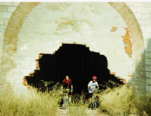
The remaining trails can be used by the adventurous. Depending on the trail there may be little or no signage, tunnels with no lights, rough surface or navigational issues. These rail-trails are not dangerous but are usually more challenging – and quite possibly more fun for experienced walkers and bikers.

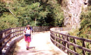
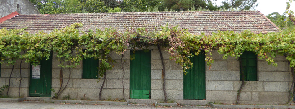
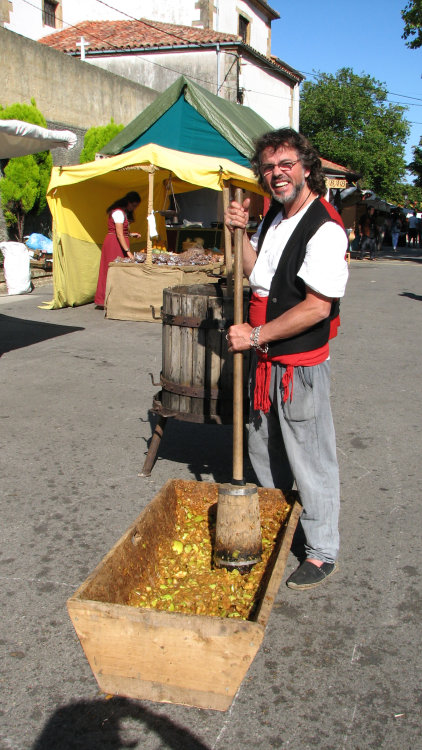
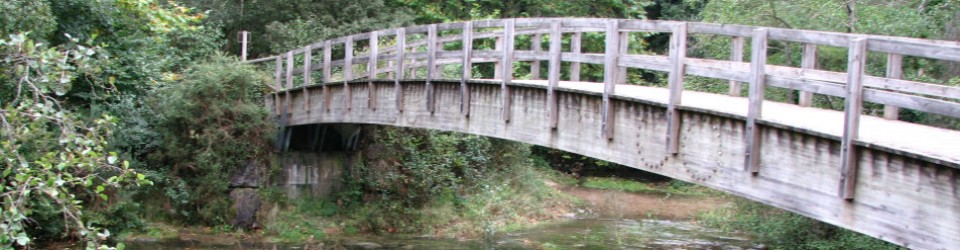
Play detective! While on the Vias Verdes, watch for signs of their rail history, an detective game that’s fun for adults as well as kids. Check out the railbed itself, complete with bridges, embankments and tunnels. Look for old train infrastructure like loading docks, water tanks, signage, freight yards and an occasional tie still embedded in the ground. Notice the “recycled” stations, somehow still train-like but with new uses like bike rental, art or music schools, police or fire stations, hotels, restaurants, libraries, a car wash, bathhouse for swimming pools, churches or even part of a convent.

For more information see website www.viasverdes.com – the English section is pretty good.

For route information, go directly to itineraries / itinerarios link at top left. All trails have basic information on distance, maps, trail surface, and some trails have full route information on accommodations, local fiestas, bike rental, tourism offices (where you could ask about horseback riding). Look for the green leaf on trail listing to see what trails have extra information. Most routes have comments by users (in Spanish), good to check especially if you are less experienced or traveling with children.

Want some suggestions? See below – an asterisk* after the name indicates trails with more route information on website.

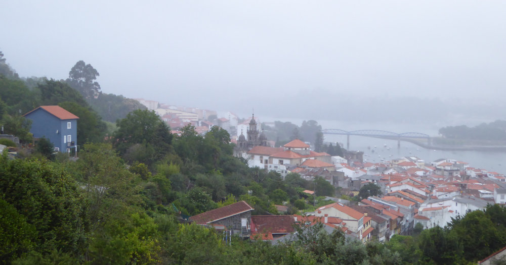
Carrilet – I (Girona)* An old mining railroad that also had passenger service. Follows a pretty valley between medieval Girona and Olot. Best parts: Olot – Les Preses and San Feliu de Pallerols –

Amer. A personal favorite, near pretty villages, a lovely natural natural park, Girona city and more.

Terra Alta (Tarragona)* Inland Tarragona, goes through wine country and a convoluted landscape of low mountains. Lots of tunnels, most light up automatically as you enter, but good to take a flashlight just in case. Best part: Bot – Pinell de Brai (in that direction, downhill). From Pinell you can continue on the Baix Ebre rail-trail to Tortosa and then to Amposta on the Ebro Delta.

Senda del Oso (Asturias) An old mining railroad. Spectacular scenery, try to see at least Peñas Xuntas gorge. This rail-trail is usually considered one ove the best in the country. Near Oviedo and several of the Asturian pre-Romanesque churches.

De Pas (Cantabria)* From mountains almost to the sea, this rail trail has Cantabría’s beautiful green scenery. Goes through Puente Viesgo spa town.

Plazaola (Navarra)* Originally a mining railway, later enlarged and lengthened to include passenger service. Pretty mountain route, be sure to travel north for a downhill cruise.

Sierra de la Demanda (Burgos) Another old mining railroad, see the smelting chimneys in Barberillo de los Herreros. The whole trail is pretty, perhaps the best is around Pineda de la Sierra (nice church). This railbed continues north (unsigned) to near archaeological site Atapuerca, discovered when the railroad was built in the late 19th century. The southern end is near various cultural sites in eastern Burgos.

Alberche (Madrid) A Primo de Rivera project that never saw trains, what now remains is from San Martin de Valdeiglesias to Picadas dam. Best part: along the Picadas reservoir, starting by the M501 highway. Not signed but following edge of reservoir no way to get lost. Absolutely flat, nice scenery, a good day trip from Madrid.

Jara (Toledo)* Another Primo de Rivera project, this trail is in western Toledo, between Santa Quiteria and Calera y Chozas. Usually considered one of the best rail trails in central Spain, when traveling north it’s a long smooth downhill, with typical La Mancha-Extremadura scenery. The southern end is near Guadalupe monastery.

Sierra (Cadiz-Sevilla)* Yet another Primo de Rivera project, fully built and never used. Several of the old train stations have been converted to hotels and restaurants, one to a bird-watching center (near Zaframagón bluff, huge vulture colony). Pretty scenery. Near Ronda and the white villages.

Aceite (Jaen)* Southwest from Jaen through a typical landscape of olive groves, with nine iron bridges from the 19th century. The roughly parallel highways would be an interesting back route between Jaen and Granada.

Via Verde trivia
– The first: Senda del Oso and the Carrilet I were both created in 1993-94, Aceite shortly afterwards.

– The most visual: For scenery: my personal choice would be the rail-trails in the green north, other people would choose the more Mediterranean routes in the south and east. For impressive train infrastructure (bridges, tunnels, etc) Del Aceite, la Sierra, de la Jara, Serpis, Plazaola, del Oso are all good choices.

– How a Via Verde is created and managed: The process of creating a rail-trail starts at a local level, usually when a local government contacts the Fundacion de Ferrrocarriles Españoles (FFE) to ask about turning an unused railbed into a rail-trail. In some cases, the FFE contacts local governments to suggest the idea, especially if they’re coordinating a project in an adjacent area. To encourage local governments to consider this idea, the Foundation maintains a pretty good website and does ongoing promotion like conferences and visits to functioning rail-trails.

Once the process starts, the FFE answers questions, gives ideas, helps with viability studies or proposals to get funding. They Foundation doesn’t finance the projects directly, but they help find financing from governmental sources or sponsers. The cost varies tremendously depending on the condition of the railbed, but can easily reach 25,000 euros for a kilometer of trail.

A Via Verde needs to be well designed, useful for local people and a good draw for tourism to make that investment in money and energy worthwhile. Through good planning, good luck or maybe the boom in active travel, most rail-trails are quite successful, bringing recreational options for locals, employment and eco-friendly development to rural areas.

When the rail-trail is completed, the maintenance and management is carried out on a local level. The FFE displays information on the Via Verde website, and acts as a watchdog to be sure the local government fulfills their obligations. If a Via Verde is not managed correctly – unauthorized motorized vehicles on the trails being a big issue, lighting in long tunnels another – the FFE posts a notice on their website, hoping the problems will be solved. Theoretically a trail can be downgraded, which could reduce the number of users and revenue for an area.

Potty Talk

Yes, this is relevant. All will be revealed.


So the urge strikes when you are far from home. What’s a girrrlll gonna do? 

Because yes, this is for women. Men have it a lot easier when needing a bathroom break.

Urban needs
Locals in Spain joke that there’s a bar/café every other block in most cities – until you desperately need a coffee, a beer or a potty break, then there are none. In smaller towns the rule of thumb is bar in the main square, bar on the highway, though yes, there are towns where that rule does not apply and even (gasp!) towns with no bars.

Cultural notes: in Spain we call them “bars”, which in English may sound alcoholic, but in Spain most places serve coffee, alcohol and some kind of food. There are several words for bathroom: aseo, servicio, baño and WC are the most frequent. In most places, the bathrooms are only for clients; if you really, really don’t want anything, you can offer 50 centimes or a euro and gesture at the bathroom or ask if you speak Spanish. This has become standard practice some places on the Camino / Road of St. James.

Pick your place: Gone are the bad old days of really deficient bathrooms. Gone (thankfully!) is Elefante toilet paper, brown paper bag on a roll, also gone is crepe-paper toilet paper (neither very efficient or user-friendly). Now most public places have clean or very clean bathrooms, though some might be missing hand soap and every now and then toilet paper. Tip on the TP: check on the wall before you go into your stall. Some public bathrooms now have a big dispenser outside the stalls, grab what you need before going into your stall. (this might sound silly, but does eliminate the task of looking into all the stalls until you find one with paper). And yes, it’s a good idea to always have Kleenex with you, just in case.

If you are often out and about in your city, it’s good to locate the best not-bar potties on your usual routes. This is especially important if you are often with kids or if you sometimes have sudden urges. Here are some of mine in Madrid:

Corte Inglés department store in Callao, second floor next to the elevators (other “Corte” stores are also good choices but I never remember where the WC is located in most stores, this one is easy to find). FNAC in Callao, top floor. Bus stations at Moncloa, Principe Pio and Plaza de Castilla; for the last in the underground station and also surface station between the leaning towers. (yes, these are usually all quite clean). Most Mercadona supermarkets. Retiro park, three WC that I know of (near Angel Caido, near the bandstand on north side of the park, near the southwest corner of the big lake). And last but definitely not least, the brown-box freestanding bathrooms, on the street various places around the city. They cost 10 centimes and yes, they really do seem to self-clean after each use, I’ve never found an icky one.

On the trail
Sooner or later it’s going to happen. You need a potty break when there are no potties to be had. This is not a major problem, though the first time might cause some anxiety. Just keep some things in mind:

Pick your place. (duh). Get far enough away from the trail to not be obvious, but not so far away that you have problems finding your way back, especially important if you are in thick vegetation or on a lightly travelled trail. This may sound silly, but people can and do get turned around after a pee-break. If you are with a group, it’s good to tell someone you are taking a break, perhaps with a code phrase like “looking for a green door”, borrowed from a long-ago hiking friend and now my own code for walking with groups (yes, that’s the reason for the photo at the top, now you know!).

Know the unfriendly plants and stay as far away as possible. Brambles and other thorny things are obvious, but you should also know more or less what poison ivy looks like, and in Spain, stinging nettles.

Leave no toilet paper. This is a no-brainer, but many people do not follow this simple rule. There several ways around this, of course: pack your paper out in a plastic bag, dump the contents at first trash can; don’t use at all, drip onto panty liner and clean yourself up at first opportunity; peecloth made of an old sheet or bandanna, kept in plastic bag and washed out as frequently as possible.

Be fast and / or discrete, especially important if you are on a well-travelled trail like the Camino (Road of St. James).  One fabulous way to be discrete is to wear a skirt for hiking, that way you will rarely if ever be caught showing the unshowable (more on that idea here http://www.bridgetospain.com/hike-like-a-girl/ ). Another way to be fast is a F.U.D. or female urination device. These thingies are also known as pee-funnels (yes really) and let women pee standing up, just unzipping your pants and using the funnel as per manufacturer suggestions and your own common sense. Women seem to have strong opinions about these devices, from “game-changer” to “useless”. That seems to depend partly on strength of quads (for squatting) and / or open-ness to strange new ideas (of course these work when in really icky bathrooms as well as on the trail).  If this device sounds like it might work for you, read reviews of the various F.U.D. brands out there as they really are different. Do some googling with F.U.D. or pee-funnel. Oh, and some suggestions for F.U.D use: practice in the shower first, learn about aim, and do not pee into the wind.

Aguilar de Campoó, the cookie town

Aguilar de Campoó, home to amazing old churches, is also nicknamed Cookie Town.

Yes, really: for many years Aguilar was home to the classic “María Fontaneda” cookie, a round cookie sort of like graham crackers but less crumbly. “Marías” are now made elsewhere by another company, but the cookie type is such a classic that the cookie name “María” is almost synonymous with round, brown breakfast cookie for dunking in milk.

Though Fontaneda* is gone from Aguilar, two other huge cookie factories still manufacture in the town (Siro and Guillon). For a more home baked cookie experience, the nuns at Santa Clara monastery make a wide variety of cookies and other sweets, and there’s a good pastry shop in the Plaza de España, very near San Miguel church.

While the cookie connection is sort of quirky, the old-church connection is a really big thing in Aguilar and the surrounding area. Here’s a short list of old churches and other old stones that you should try to see:

In Aguilar:

Santa Maria la Real monastery, mostly Romanesque style, on west edge of town. This was one of the wealthiest and most powerful monasteries in the area for a long time, with some ups and downs due to secular and religious politics. After the mid-19th century expropriation by the state it was abandoned and basically dismantled. Almost in ruins, there were several unsuccessful attempts to restore it, finally in the late 1970’s a private group got the rehab going. Today it is part hotel (see below), part local high school, part museum and part center for Romanesque studies. The museum includes a fabulous old cloister (photo above), the old chapter house and the church, with various models of Romanesque churches in Palencia province, some cleverly designed to open and view the interior. Alas, the museum information is not shown in English. Odd schedule to fit into the main use as a school, but they have several guided tours each day.

Santa Cecilia church, Romanesque style, on the hill above town just below the castle. Lovely, simple lines inside and out. Inside: look for the Massacre of Innocents column capital, to left of main altar.

San Miguel church, mostly Romanesque and Gothic style, in main square.

Santa Clara monastery, only the Gothic chapel as the rest of the convent is cloistered. If you want cookies, you buy them through a lazy-susan and screen arrangement so you never see the nuns. See end for website with times to buy the cookies.

Castle ruins, on hill above town. Mostly 14-15th c, on site of earlier fortress. The climb looks imposing but it’s not so bad and the view is nice. Town walls: the lower town was surrounded by a separate ring of walls, today we can see six city gates (best gates for photo ops are Reinosa, Tobalina, Paseo Real and San Roque) and a short stretch of the old wall by the Paseo Real gate.

Various for walk-by or strolling: Palaces with carved coats of arms on the façades. Plaza de España, a typical Castilian main square, fully lined with arcades and lots of typical bars or cafés. (ummm had a wine in one for 50 cents!). Riverside walkway and Isla park, nice walkway on south side of river and part of north side, pretty park on an island in the middle of the river.


Near Aguilar:

The area is just packed with Romanesque churches, supposedly more than any other equivalent area in Europe. That’s partly because in the centuries for building Romanesque architecture (11-13th) this area was important as border between Muslim and Christian Iberia; as history’s main events moved south it became a poor backwater without resources to tear down and replace the old churches. Take your time exploring, if you like history and architecture you will probably want to come back.

Santa María de Mave: Romanesque church of an old monastery, closed in the the 19th century expropriation. Lovely church, well worth a visit but with a quirky schedule, depends on time of year and day of the week. Ask for help at Aguilar tourism office to arrange a visit. The old monastery is now a small hotel, open April to November (see below). Near Mave, about seven kms south of Aguilar.

Santos Justo y Pastor: cave-church, probably 8-9th c, enlarged 12th c. This area has a number of cave-churches, this is one of the larger ones. Another church well worth a visit but with equally quirky schedule, though this one seems to be open more than than Mave. In Olleros de Pisuerga, about five kilometers south of Aguilar.

Mount Cildá castro, hilltop fortress town. Spectacular and easily defendable site, this village was inhabited off and on from the first century BC to 8th century AD by Celts, Romans and Visigoths. Excellent lookout for the entire area, and right over the Horadada canyon (see below). Near Olleros de Pisuerga, about a 45 minute walk, unpaved road from bridge over the Pisuerga at edge of Olleros, sign showing Castro de Monte Cildá. Loop option for experienced walkers: a much smaller, semi-marked trail starts at front door of the cave church, intersecting with the unpaved road at signpost for the fortress-town, go by the path and return on the road for a loop route.

Interesting churches a little farther away: Santa Maria de Valverde cave-church, about 30kms east of Aguilar in Valderredible / Polientes, considered the best of the area’s cave churches. San Salvador de Cantamuda Romanesque church, about 35kms upstream following the Pisuerga river.

Natural sights: The Horadada or Pisuerga river canyon is just southeast of town, excellent view from Mount Cildá, the train track goes through the canyon, too. The Tuerces near Villaescusa de las Torres, about six kms southeast of Aguilar, an area with limestone rock formations similar to the Torcal park near Antequera (near Málaga) or the Enchanted City (near Cuenca). Large reservoir about two kilometers west of Aguilar, has picnic and swimming areas. Cueva del Cobre, cave long considered to be beginning of the Pisuerga river; recent studies have proved that incorrect but the cave is still interesting, though not prepared for tourism. Near Santa Maria la Redonda, a little northeast of San Salvador de Cantamuda.

Walking and biking: Two lesser-known Caminos go through the area: the Camino Olvidado and the Camino Lebaniego. Other shorter walking routes have been marked by Aguilar City Hall or the provincial government.  There are lots of small paved and unpaved roads for biking.  One good biking route is Pedaling the Romanesque (Pedaleando el Románico), a 60 kilometer loop around the reservoir that visits many towns with old churches.


Nuts and bolts:

Where: Aguilar de Campoó is in the northeast part of Palencia province, a few kilometers from Cantabria and Burgos provinces.

Getting there from Madrid: Alsa bus line, station in town. https://www.alsa.es/ Train, but look at schedules carefully as some departures transfer in Valladolid. Station a few kilometers from town, taxi is five euros. Bus service for departures / arrivals of slower Regional Express trains; those are the departures with transfer. http://www.renfe.com/ Both bus and train stops are on the way to Santander.

Where to stay: in town, best is the Posada Santa Maria la Real, website: http://www.posadasantamarialareal.com/ A variety of other places in town are shown on tourism office website (my opinion: best to avoid Hotel Cortés Poza).

Where to stay, nearby: Charming small hotel similar to the Posada in Mave, 6kms from Aguilar, only open April – November, website http://www.elconventodemave.com/ . Several other small hotels or casas rurales (b&b) within 10km radius of Aguilar.


More information at:

Local tourism office: http://www.aguilardecampoo.com/ Very helpful website. Town tourism office is on the riverside Paseo de la Cascajera, a little west of the Plaza de España main square. Also very helpful, their pamphlet-map is informative and well-designed.

Tourism for Palencia province: https://www.diputaciondepalencia.es/sitio/turismo/ This province is relatively close to Madrid and has a lot to see; if you plan to drive to Aguilar, this website can help you decide on some cultural rest stops on your way there or return. (San Martin church in Frómista, San Juan de Baños church in Venta de Baños, just to mention ideas in keeping with the church theme of this post). There’s a provincial tourism office in Aguilar de Campoó, in the Plaza de España just to the left of San Miguel church as you look at church façade.

Santa Clara convent (for cookies and to visit the church, rest is cloistered): http://www.santaclaraaguilardecampoo.es/dulces.html Want cookies? Click on Horarios then look for “Obrador”

Notes:
Special note for fall 2018: Edades del Hombre / Ages of Man exhibit is in Aguilar until December 9. More information at: http://monsdei.lasedades.es/

*The cookie family Fontaneda bought and restored a castle in Ampudia (a little west of Palencia city), where their foundation manages and shows the castle (home to an extensive and varied private collection of just about everything) as well as renting venues for Events. This would be a possible stop if driving to Aguilar. More info at http://www.castillodeampudia.com/

Some are hot, and some are not.


Some are hot and some are not.

Ahem. We’re talking peppers here. Padrón peppers to be specific. As the Galician saying goes: pimentos de Padrón, unos pican e outros non. (Padrón peppers, some are hot and some are not).

So what are Padrón peppers? They’re a smallish green pepper from Spain’s Galicia region, and yes, some are hot and some are not. Usually not kill-taste-buds hot. But sometimes eye-watering hot.

But let’s backtrack a bit.

First of all, Padrón is a bit of a misnomer. Technically speaking, these peppers are from the Herbón area south of Santiago de Compostela (Galicia region, northwest Spain). Padrón is a town in the area, but important for the peppers: San Antonio Franciscan convent (14th c) is in the Padrón parish, and it was the Franciscan monks who brought these peppers from the Americas, probably in the 16th century.

The peppers are so unique in Spain that they have their own Certified Origin, registered as Pimientos de Herbón, not Padrón, an important technicality if you’re at the market and want to be sure you get the right thing. But in a bar or if talking with friends, for now they’re Padrón peppers, just like they’ve always been – perhaps the alliteration makes the name sound better.   And scientifically, they’re Capsicum annuum.

Padrón peppers are best shared with a group of friends. Hot from the frying pan, liberally sprinkled with coarse salt and heaped on a plate, they’re an inviting sight. But beware: some are hot, and some are not. Sort of culinary Russian Roulette.

The traditional way to eat these peppers: pick up by the stem and pop the whole thing in your mouth (more cautious people will nibble the end first). Your friends are watching, either openly or out of the corner of their eye, evaluating the temperature of your pepper by the expression on your face. The theory is that odds change as more or fewer hot peppers show up on the plate – and while technically about 10% of Padrón peppers are hot, that doesn’t necessarily mean 10% on your shared plate. They could all be mild, or half hot: the 10% rule is over the entire production of peppers.

What makes the peppers hot is capsaicin, just like Padrón pepper “cousins” serrano or jalapeño peppers. But in Padrón peppers, the amount of capsaicin varies a lot depending on how much sun and water the plant got when growing. Traditionally Padrón pepper pickers have been women, and they mix the peppers they think will be hot with ones that will be milder. Thus the variation in pepper temperature when they reach your shared plate.

There is lots of lore about identifying which Padrón peppers are hot. Pepper experts say that the hottest peppers are longer in shape, or have longer stems, or are bigger and a bit reddish, or even that the coarse salt sticks less to hot peppers than to mild peppers. And a restaurant owner (as much of an expert as anyone on this topic) says that late in the season in a dry year, there tend to be more hot peppers, and hotter hot peppers.

Got a hot one? Don’t panic – and don’t try to cool down with water, beer or the local Ribiero wine (a great companion to any Galician tapa experience). The best solution is to eat bread. If at all possible, the hearty, coarse-grain Galician bread.

Still not ready to do it? Alas, the Padrón Pepper app promising to take the guesswork out of pepper tasting has disappeared from Google Play store. It had a hundred-percent accuracy guarantee: scanning the pepper with the phone’s camera it could evaluate pepper temperature. And if the pepper-eater disagreed with the analysis, the problem was with that person’s palate, not with the app.

So until the app or something similar appears, you’ll just have to take your chances with Padrón peppers: some are hot, and some are not.

Padrón pepper talk:

Padrón or Herbón? The Certified Origin regulation council is trying to change the name officially to Herbón peppers, to differentiate their peppers from similar peppers grown elsewhere.

Pepper season: the true Padrón pepper season is May to late October, though now peppers are grown in hothouses in other parts of Spain and Morocco and available most of the year. Hothouse peppers might have a slightly different taste and different proportion of hot and not.

Padrón Pepper festival: usually the first Saturday in August in Padrón town.

More about the peppers from the Herbón regulation council: http://www.pementodeherbon.com/en/home.htm

Camino Inglés – the English Route

Traditionally English pilgrims (when England was still Catholic) or other northern European pilgrims (ditto) sailed to the ports of El Ferrol or La Coruña and journeyed south from those points on what we now call the Camino Inglés (English Route). It’s a north-south route straight into Santiago without coinciding with the French route.

Nowadays the Camino Inglés is a lot less travelled than the other historical routes like the French, Portuguese or coastal routes. If you’ve done other Camino routes, or have not (yet) but want a shorter or less travelled option the Camino Inglés is a good choice.

Guidebook: John Brierley’s book on Sarria – Santiago – Finisterre, including the Muxia circuit and the Camino Inglés.

When walked: July 7-11, 2017

Route: Ferrol – Santiago, about 123 kilometers. Another branch starts in La Coruña, about 76 kilometers so does not qualify for the Compostela certificate (if that is important for you), though La Coruña is a nicer city than Ferrol.

What’s good and less good: I really liked the mixture of sea and mountains first three days, then the transition to countryside. Lots of varied forests, including chestnut trees at a low altitude. Less good: walking Ferrol – Fene (about 20 kilometers) has a fair amount of industry (old shipyards) and warehouses. Part of that is unavoidable but I can’t help wondering if they could have routed around instead of through some of the warehouse areas.

Usual stages and other ideas: Brierley’s suggested six stages are probably the best for distances and infrastucture: Ferrol – Neda (15.5k), Neda – Pontedeume (16k), Pontedeume – Betanzos (20.7k), Betanzos – Hospital de Bruma 28.4k, big hill), Hospital de Bruma – Sigüeiro (25.2k), Sigüeiro – Santiago (17.2k), all distances as per Brierley. I did it in five stages (Ferrol – Pontedeume first day), and it’s also possible to break Betanzos – Hospital just short of the halfway point.

Important note: route changes in near future: if you are planning to do this route soon: some routing changes are planned and will be marked this fall, so be aware that current guidebooks will not be 100% accurate. New route will hit all the major towns and many of the smaller ones; in some places changes will be minor and in other places more important (one local woman says the new route from their town into Sigüeiro is much better than current route). At least one change has already been made: shortly before Hospital de Bruma (well after Casa Julia): the official signage seems to disappear, replaced by handmade yellow arrows nailed to trees and newly painted arrows with slightly different color of yellow. Fear not, the apparent improvisation is the real route (for now) and re-connects with official signage.

Signage: Better than expected but not perfect. There are lots of crossroads and you have to watch carefully, sometimes signage is there but not immediately visible from your angle or covered by vegetation. Lots of arrows painted on the asphalt.  Going through industrial / warehouse areas can be tricky, especially just outside Santiago, where there is almost no signage (basic idea for Santiago warehouse area: after turning left into warehouse area stay straight ahead through two rotundas, walking on left side of the road, warehouses are on the right side of the road. Signage reappears shortly after last warehouses).

Infrastructure: Fewer supermarkets, albergues, pensiones, hotels, bars than on the Camino Francés, Camino Norte or Camino to Finisterre. Not a deal-breaker, but you do need to be more aware of your supply places.

Places to sleep: Most of these places are listed in Brierley book. Ferrol: I stayed at Hostal La Frontera, good location but a little minimalist and bar doesn’t open until 8am. Nearby Hostal Zahara (not in Brierley) looks nicer and bar opens at 6am for breakfast (excellent tomato toast). Camino friends recommended La Almendra. Pontedeume: I stayed at Hostal Norte and wouldn’t repeat, no elevator, very minimalist, bar opens at 8.30am. Nicest hotel Eumesa is at a very busy intersection, Pension Luis is well located but looks very small. My pick here would for a repeat visit probably be Hostal Allegue. Betanzos: I had a reservation at Posada Cheiño, but switched to Hospedaje Betanzos, where a little more money got me a huge room with bathroom (other place didn’t have bathroom) and access to a full kitchen. Camino friends say the municipal albergue here is excellent. Hospital de Bruma: I stayed two kilometers up the hill at Hotel Canaima (Alto do Viento), nice room with full bathtub to soak your weary body after long day and big uphill – though neither dinner nor breakfast at the hotel was memorable, and price was a little high. Almost right across the highway from the hotel: Pension o Meson Novo, less expensive though no idea on what it’s like (you do not have to return to the albergue to continue the Camino, there’s a paved road that does a diagonal to join the Camino several kilometers beyond the albergue). Same Camino friend who recommended Betanzos albergue says the Hospital de Bruma albergue is very good, but there are only 22 spaces so the hotel / pension are good to know about. Sigüeiro: Stayed at Sigüeiro hostal and really liked it, this was my favorite accommodation on this trip. New with modern design, nice bed and interesting bathroom setup (shower and toilet in one space, sink outside in the room, much more efficient for sharing a room), very good dinner and good breakfast.

Places to eat / have coffee: Surprisingly, I did not see any “menu del día” deals. This fixed price menu idea is all over Spain, not just on the Camino, and not seeing any at all was strange. That has price implications, since the fixed price menu is usually a much better deal than ordering off the menu, so you will need to pick and choose both your places and what you eat. Places to stop on the trail: The Brierley book is pretty accurate though not 100%, due to scarcity of stopping places it’s good to plan ahead to be sure you have water and food. Places I stopped showing my stage breakdown, either memorable or not in Brierley or not well described in Brierley, other bars exist most days: Day 1: Neda-Santa Maria, no bar at Neda pedestrian bridge by the albergue, continue another 15 minutes to find a bar just beyond Santa Maria church (not in Brierley), Vilar de Colo bar is in the warehouse area, not in the town. Day 2: Miño: bar Green (memorable), turn right down short flight of stairs when you see the basketball court-square, bar is under arcades on left side of the square. He gave me a chunk of homemade poundcake (bizcocho) and slices of melon and watermelon for free, plus some tourism pamphlets (supermarket in same square). Day 3 ( Killer Day Betanzos – Hospital de Bruma): Only two bars on a long and challenging day, first in Presedo,  Xente do Camiño (memorable) which is well after the sign for the local albergue, good place with food and big outdoor sitting area and second in Vilacoba, Casa Julia which is small place right on the highway, easy to walk past but a stop is highly recommended since (for now) this is last stop before Hospital de Bruma. Casa Julia is also the place they count pilgrims, see below, if you speak Spanish chat with the young man. He was making filloas (local version of crepes) when I went by on a Sunday, handing them out to all customers. Day 4: Centro/Calle, bar Cruceiro, friendly with good potato omelette, empanada and poundcake, a classic Camino stop. Day 5: Hotel Castro (not in Brierley), about 2-2.5 hours from Sigüeiro. Places in towns (mostly dinners), I ate at these places: Ferrol: bar-restaurant near main square, right in front of Pescaderia fish market, excellent seafood, big outdoor sitting area. Pontedeume and Betanzos both dinner spots were forgettable, both towns have a lot of options. Breakfasts in those towns: Pontedeume, Café Martinho is right in front of the bridge, opens 6am. Betanzos, Churreria-cafeteria just to the left of calle Rollo (Camino street), near though not on calle Venezuela, opens 6.30am except Sundays when 7am or in fiestas when 8am. Hospital de Bruma, there’s a restaurant right by the albergue that my Camino friend likes, I didn’t stop since I was going on to the hotel, where dinner was forgettable. Sigüeiro: cruised town and did not find many options, perhaps because of Monday closings, ended back and Sigüeiro hostel and had a yummy dinner of mushrooms and potatoes, good food at a good price AND they have a secret back terrace that you do not see from the front, very good choice for dinner.

Beaches: Weather was not cooperating during my walk so I didn’t even dabble my toes in the sea but here are my observations: several beaches on the way out of Ferrol, excellent La Magdalena beach in Cabanas just before Pontedeume, and just after Miño near Ponte do Porco.

Fiesta Betanzos: My trip coincided with the Medieval Market in the medieval town of Betanzos. Market was cute and had nice things – but backpacking you have to think at least twice before buying anything. If you are planning for the future and want to see this or avoid it (town was packed to the rafters), check the dates: it’s probably the second weekend in July.

People on the trail: This route is a lot less travelled than other routes – my “bubble” (people more or less in same space on same day) was about 25-30 people. The young man in Casa Julia (see above) says he counts pilgrims and that day (a Sunday) he had seen 21 so far – he counted 2000 pilgrims last August (about that many daily arrive in Santiago early July). Obviously 25 people a day is not a lot – but several albergues are about that size so good to plan accordingly and know your options.

Going alone? I saw two other women walking alone, and two other Italian women who were sort of together and sort of not together. I felt completely safe, but it must be said that women alone are still a little unusual here so if you are a woman and go alone you might get some comments (like I did). For that reason, if you have never walked alone and are feeling a little uneasy about it, perhaps a more-travelled route would be better for a first solo experience.

Want more walking? Before your Camino Inglés: San Andres de Teixido is about 50 kilometers from Ferrol, according to the Ferrol tourism office marked all the way with stone pillars with a red fish (see photo). Actually, if you want to put together a longer route, part Camino de Santiago and part local custom, start here: https://caminoasanandres.com/ (Spanish only, sorry), scroll down a tiny bit and click on Caminos de San Andrés: if you know your Camino de Santiago routes you’ll see Ribadeo (north route) and Ourense (Via de la Plata / Sanabres route), as well as other towns on the Camino Ingles as starting places to walk to San Andres, so you could put together a longer combo route in this area. Galician lore says that if you don’t visit San Andrés while living, you must visit after death, so locals often make pilgrimage to this site, more important for them than going to Santiago. Learn more about the San Andrés route: https://en.wikipedia.org/wiki/San_Andr%C3%A9s_de_Teixido     After your Camino Inglés: what better choice than Santiago – Finisterre – Muxia? The journey to Muxia for Virgen de la Barca / Virgin of the Boat is again more important for locals than Santiago – celebration date is the first Sunday after September 8. For more about this shrine go to http://concellomuxia.com/en/item/santuario-da-virxe-da-barca/

Cabo de Gata: Sea and Sun – and lots more


Like sun? Like nature? Like outdoor sports? Like lesser-known destinations, and don’t mind a longer drive or figuring out some transportation options?


Then consider Cabo de Gata, the southeast tip of Spain. Almost desert-dry, with the lowest rainfall in all of Europe, so your chances of warm, dry weather are pretty good most of the year, and there are things to do if the sun doesn’t shine during your entire stay.

So exactly where is this? Between Mojácar (south-ish on Spain’s east coast), and Almeria city (east-ish on Spain’s south coast), and everything east of a line through Níjar connecting the two places – plus a bit north of that line (Sorbas and Tabernas).

Cabo de Gata Natural Park: One of the main attractions of this area is the Cabo de Gata Natural park, declared in 1987. Thanks partly to park zoning, the coast between Mojácar and Almería has mostly escaped excessive development; farther back in time the lack of water also hindered development, so now you can enjoy a relatively pristine coast. “Relatively” pristine, as ironically, the park did bring some rather unfortunate building in urban areas, along with much needed money from increased tourism. Hopefully the park zoning and environmentalist interest will help guide the area’s development in the future.

So what’s to see?

Along the coast

— Villages or man-made: Mojácar, charming white village on a hill overlooking the sea. Agua Amarga (south of Mojácar) and Cabo de Gata (south coast, east of Almeria), two old fishing villages, now developed but still with a bit of old flavor. Cabo de Gata lighthouse on southeasternmost tip, placement and view. Cabo de Gata saltpans, probably used in Roman times and still in operation; saltpans are between lighthouse and village. Almeria city, castle and Cathedral built on site of a 10th century mosque; can see bits of mosque but not as spectacular as Córdoba. Almeria city also has a museum with some archeological artifacts from the area, though the best pieces are in Madrid.

— Nature: View from Mesa Roldan lookout. Rock formations, all along eastern coast but especially between San José and the lighthouse, in the sea and on the beaches. Crater of old volcano, northwest of Los Escullos. Flamingos and other bird life in salt pans near Cabo de Gata village. Sand dunes, especially Playa de los Genoveses. Best beaches: Monsul and Genoveses beaches near San Jose. Agua Amarga beach, small but nice, and beaches south of that village, some only accessible on foot at low tide. El Playazo, near Rodalquilar village. Cabo de Gata village beach is long but rather rocky. Some nice beaches near Carboneras (east coast) but nearby cement factory is a bit off-putting. Mojácar’s beaches are smallish and outside town. San Pedro nudist beach just north of Las Negras (nice walking path to get there, 40 minutes); this used to be a lovely, almost pristine beach but has some issues now –illegal bars, “alternative lifestyle” settlement that is not terribly respectful of the environment.

Inland

— Villages or man-made: Near Tabernes: several US – Western town film sets remaining from the 1950-1970’s era of “paella westerns”, host to stars like Clint Eastwood, Brigitte Bardot, Harrison Ford, Raquel Welch and others. Nijar village, one of largest in the area and typical of inland Almeria. “Norias” or water-wheels to draw water for irrigation from underground, one of the best is in Pozo de los Frailes. Abandoned gold mines near Rodalquilar. Cortijo del Fraile ruins near Rodalquilar, site of the events described in Federico Garcia Lorca’s tragedy Bodas de Sangre (Blood Wedding). Archaeological sites (prehistoric and Roman), interesting for history buffs.

— Nature: Tabernas desert, limestone “karst” formations around Sorbas: at least Aguas and Covadura caves, also some gorges so narrow they look like caves.

Environment / sports: There are lots of opportunities for activities in nature (diving, kayaking, hiking, cycling, horseback riding, caving in Sorbas) BUT please remember this is a natural park in a fragile environment, with permit requirements or restrictions for some activities. As always, leave no litter, and if you see any left by less considerate visitors, perhaps you could do a good deed and pick it up. Information on active travel companies in links below.

Shopping: Traditional crafts include ceramics (often cream and blue, some greens and grays). Rag rugs called “jarapas”: these rugs were often used on beds to protect the bedspread. Woven grass mats and baskets. “Indalo” fertility goddess symbol, a stylized stick figure with outspread arms. Good places for shopping: Níjar, Sorbas, Mojácar, San José.

When to go: October – May, with early June and late September a possibility though with higher temperatures. I have swum in the ocean in December (and don’t consider myself especially fond of cold water). BUT….. If it rains, it (usually) pours: Yes, this is the driest part of Europe, but when it rains, it is often a downpour that can cause flash floods. Notice the number of no-bridge stream crossings, where minor paved or unpaved roads dip down over a gully. Heavy rains can and do fill these empty gullies with roaring rivers (hard to believe but true). If that happens, do not try to drive across what was yesterday a dry gully. Ask locals about alternative routes, or even better, ask local police or Guardia Civil; they’ll be in charge of any rescue operations so give them a chance to stop the rescue situation before it happens.

Best villages to stay: Mojacar, Agua Amarga, Las Negras, Rodalquilar (a little inland), San Jose, Cabo de Gata all have hotels of different styles and prices.

How to get there: By car: Fastest but less scenic: southeast to Murcia, then south through Lorca; this is the best route if you plan to stay in Mojácar or Agua Amarga. Most scenic, more challenging driving: to Granada then south through Sierra Nevada and southeast to Almeria through the Alpujarra mountains on smaller roads (several possible routes). Other transportation: Almería station is centralized for train and bus. Madrid – Almeria is a very long trip, so direct bus not a good idea, but Alsa buses run from Jaen, Granada, Sevilla and Malaga. Renfe has direct Madrid – Almeria train service, usually one or two trains a day, sometimes more April-September (www.renfe.es); alas, the convenient night train seems to have disappeared. Almeria does have an airport, and flights may be cheaper than the train. Many towns in this area are connected to Almeria by bus, so if you don’t plan to move around much, public transportation is possible.

And last but definitely not least, that question you may be asking yourself: Why is this called Cape Girl-kitty? And the answer is: the name doesn’t come from “cat” but from “agate” (semi-precious stone) that used to be found along the coast. And yes, if you know your rocks and you’re really lucky, you still might find an agate or two.
Websites for more information / pre-trip planning: English version not always available or complete.

https://www.cabogataalmeria.com/ Good general site with lots of links, well organized. This would be my first pick. On this site, info on the “Western” towns: http://www.cabogataspain.com/Gata-Nature-Reserve/Activities/Leisure/Western-Village-Tabernas.html

Other sites:
www.cabodegata-nijar.es
www.degata.com

Inicio

http://www.museosdeandalucia.es/cultura/museos/MAL/      Website for Almeria Archaeological museum.

https://www.turismodealmeria.org/prepara-tu-viaje/como-llegar/    Some info on bus lines in the province of Almeria.

More information, once you’re there:
Park visitor’s center: Centro de Interpretación de la Naturaleza Las Amoladeras,
Highway AL-3115, Tramo Retamar-Pujaire Km. 7.

Other places for additional information (park or general tourism), take your pick here: https://www.cabogataalmeria.com/Cabo-Gata/Parque-Natural/Puntos-Informacion.html


Hike Like a Girl

Hike in a skirt? Really? The same thing you wear for dress-up days at the office, to church, out on a special night on the town?

Yes. Oh my yes. I’m a total convert.

Hiking skirts came across my screen many years ago and I sort of laughed off the idea, but it stuck in the back of my hiking-brain. Last year I did my first serious forays into the world of skirt-hiking. It only took a few days on the trail to realize what I’d been missing all along.

And we’re talking skirts, not skorts. Skorts are fine for many things, excellent for travel or if skirts just feel too airy for you in some situations. Skorts also let you go with a shorter length, if that’s what you want. But when it comes to hiking, skirts have some real advantages over skorts, shorts and long trousers.


So why hike in a skirt?

–   Ease of pee: it’s a lot easier to flip up a skirt and drop the undies than to unsnap, unzip and drop trousers or shorts as well as the undies. It’s also faster and more discrete – less likely you’ll get caught showing the unshowable if you’re wearing a skirt.  And wedgies? Less likely in a skirt, less noticeable and easier to fix.  Ummm.  Some women even talk about going commando (no undies). I’m not ready for that, at least not yet and maybe never, especially in a knee-length skirt.  But it’s an idea.

–   Temperature regulation: in the summer skirts are much cooler than shorts. In cool weather, wear with leggings, and if it gets warm, just pull off the leggings without having to change everything.

–   Less washing: Since skirts are less in contact with your body (especially the sweaty part of lower body) they stay cleaner for longer.

–   Go everywhere. If you are on a multi-day hike / cultural trip and trying to pack light, a skirt goes more places than shorts or even trousers. Yes, you can wear trousers or shorts many places, but not in all countries or all situations. And even if there are no cultural issues, skirts are nicer and you might feel better at a restaurant or cultural sight wearing a skirt, especially if your other option is shorts (because skirts are almost always cuter than shorts, right?)


Making your trail skirt selection:

–   Length: Best is between just above the knee and about mid-calf: shorter and you need to be careful about sitting down or legging up on the trail, longer and you might trip over it – unless there’s an easy way to shorten temporarily like the Macabi skirt.

–   Style: too straight / tight will restrict movement, extremely loose may get tangled on trailside vegetation. Some of the straight designs have kick pleats or shaped hem that gives a little more freedom of movement, but generally speaking flared, gathered or with gores are a better choice. Especially good: a style that is not too obviously for the trail – or at least something you feel ok about off-trail if you will be doing any multi-faceted trips.

–   Waistband: many skirts are designed to ride on the hips instead of the waist – is that ok for you? Some skirts have fold over knit waistbands instead of woven waistband – that probably means pull-on style and adjustable length by folding over the waistband – is that ok with you? If the skirt has a waistband and zipper, look at zipper placement: zippers and buttons in the back or side might not be comfortable wearing a big pack and hunky waist belt. Personally I prefer a real waistband with belt loops, letting me adjust the waist size with a tug on the belt -on long hikes my waist measurement can vary somewhat, so having a real waistband and a belt (just one tug to change size) is better for me – but a waistband and belt is just a bother for other women.

–   Fabric: As for any trail clothes, all cotton is not the best because when it gets wet (sweat, rain, washing) it takes forever to dry. Better to look for blends of some cotton but more synthetic , or a technical textile like supplex nylon – feels almost like cotton but zap dries (technical textiles are not as cool as natural textiles, but zap-dry is a real advantage). Some trail skirts are wool, which I’ve never used but people who have absolutely rave about wool (cool, warm, doesn’t get stinky, etc) . Some trail skirts are knit, which I probably would avoid because knits usually take a little longer to dry, snag more easily (brambles, oh dear), and get stretched out or baggy more quickly than woven fabrics.

–   Pockets: Yes, yes and yes. It’s especially nice to have at least one security pocket closing with a zipper or snaps. Check pocket design and location – will the pockets interfere with a big pack? Are the cargo pockets nicely designed and in a place where they don’t emphasize the widest part of the anatomy?


Try skirt hiking before you buy: If this is starting to sound like a good idea but you’re still not sure, check your closet. Maybe you have a skirt to test the idea on a few day hikes: pick something you already have that is more or less right for the job and go for a hike, maybe with shorts or trousers in your pack in case it really doesn’t work. And if it really doesn’t work, ask yourself why. Are trail skirts just not for you, or was your skirt not the right thing? If it was the skirt, what wasn’t right?

What I’ve used: Macabi original skirt and Kuhl Splash skirt. For me, the first is better for spring and fall, it’s a little hot for summer in Spain (though I love it for general travel in the summer). For summer hiking my favorite is the Kuhl Splash skirt (thanks to the person who clued me in, you know who you are). It’s cool, cute and the right shape for my body – only negative aspect is that it has a little too much cotton so it takes a little longer to dry. Alas, this skirt has been discontinued, you still might find on dealers like Campmor, Sierra Trading Post or Zappos.

Some brand names for hiking skirts: Some of these are general sportswear manufacturers so you may need to filter a little to find the skirts (no websites, sorry, but a quick google will turn up any of these, perhaps adding the word skirt if you don’t find on the first try): Purple Rain / Macabi / Sierra Designs / Mountain Hardware / Patagonia / Exofficio / Kühl / Columbia / Marmot / Royal Robbins

Can’t find what you want on these sites, or looking for deals? Look on end-of-line places like Campmor, Sierra Trading Post, Zappos, Moosejaw, Shoebuy.

Not thrilled with the style of the hiking skirts you see, though you really like the idea of hiking in a skirt? Look at the more general sites for travel or urban leisure clothing like Travelsmith, Lands End, LL Bean. Especially if you end up on one of these sites, before deciding what to get think how you’ll use your skirt. Fabric content and pockets (for example) are less important on a skirt for day hikes than for long, self-contained through hikes.

Not just for girls: Some secure and forward thinking men have posted their skirt-hiking experience on websites and gear reviews. Ease of pee is not an issue; most have tried and liked skirt hiking because it’s so much cooler –avoiding what some call “crotch rot”

Cider in Spain

201612ciderapples


What traditional Spanish beverage needs a good eye and steady hands to be at its best? What traditional Spanish beverage is almost a sign of identity for its region? And what traditional beverage has a long list of health benefits?

The answer to all three questions is: sidra: hard apple cider, popular in many European countries and to some extent on the other side of the Atlantic. Here in Spain it takes on a personality all its own, with legends and lore galore.

Spain’s cider-land is mostly along the north coast: Basque region, Cantabria and especially Asturias, where about 80% of Spain’s cider is produced – and drunk, with about 90% consumed right in the region. For that reason we’ll talk about Asturias in this article – though by all means you should try sidra when traveling in other cider regions.

So what is sidra like? It’s a lightly alcoholic beverage made of fermented apple juice – in Spain usually 4º – 6º (like a hearty beer); alcohol content is sometimes higher in other countries, where the espumoso (bubbly) cider is more frequent than the natural that is so popular in northern Spain.

Cider apples are usually not table apples – they’re a little smaller and juicier. The Regulation Council for Asturian Cider accepts 22 varieties of local apples, rated as tart, sweet, bitter or mixed.

Like wine, cider makers use different mixtures of apples to get the final product they want. That’s quite an art: like grapes, apples are different every year, with varying sugar content depending on the weather, so finding the right mixture of still unfermented juices is a delicate process.

Depending on the manufacturing process and apples used, sidra can be very pale yellow to dark gold in color, and clear or slightly cloudy. Some ciders are bubbly and some are not – see the end to learn about different kinds of cider.

201612ciderpressMaking sidra natural The process is simple – many tiny cider houses and even country families and make their own for family and friends: see photo of Guillermo showing the traditional crushing – he’s made his own and explained the process, which is not very different for the industrial process.

Apples are harvested between September and late November, depending on the year’s weather and the variety of apples. Apple trees yield differently alternating years, with the even-numbered years a smaller harvest and the odd-numbered years cosechonas (big harvests), when the much larger harvest can last until early December.

First the apples are washed, then crushed to pulp separately by apple variety. The next step is pressing – the apple pulp is layered in a press that works with weight or a screw system and pressed several times to get all the juice. What comes out is apple juice, ready for the fermentation process (the almost dry apple pulp is often fed to livestock).

The juice is placed in stainless steel or chestnut wood vats to ferment for three to five months – shorter aging for a sweeter cider or longer for tarter cider, always varying with the kind of apple used. Cool weather is good for fermenting, so the temperature is controlled carefully during this time. After fermentation comes bottling in the traditional green bottles, taking care to not stir up the cider too much.

At bottling time, traditional llagares (cider houses) often still have a cask-tapping party called espicha for the holes in the cask. The espicha had – and still may have – the practical purpose of finishing off the unbottled cider in a cask or as a taste-test before buying a whole cask, but more than anything it’s a big party, with cider is drawn directly from the cask into pitchers or e traditional big glasses. Long ago, revellers would pay a flat fee into the cider house to drink all they could – and would pay again when returning after a potty break.

Sidra is as Spanish as vino  (wine) – and maybe more so in the north. So be sure to try it during your time in Spain – preferably up north, or at least in a Madrid cider bar.

Basic kinds of Asturian cider

Sidra natural is the traditional, most popular kind of cider, rather tart, even somewhat bitter if not poured correctly. Variations on this kind of cider: Natural ecológica, made with apples from orchards with ecological certification; Natural de manzana seleccionada, made with specific varieties of apples that have undergone an even more rigourous selection process.

El escanciado (pouring): Sidra natural should be poured from a bottle held arm’s height above the head into a big glass held at a slant at thigh level. That aerates the natural cider, making it a little sweeter and raising some bubbles – and that’s when true cider buffs can evaluate the cider for color and aroma. The sidra should be poured in a thin stream directly in front of the body, just hit the edge of the glass – and just enough for a few swallows as the bubbles soon disappear. After drinking, the last swig is poured on the floor to rinse the edge of the communal glass.

That’s the technique – but good escanciado is more than just technique. Style and ritual matter: a good pourer is admired for the ability to pour without looking and without splashing too much on the floor. The way the bottle and glass are held, even the flourish used to present the glass to the drinker, all are important parts of the escanciado ritual. The communal glass itself is part of the cider lore: sharing a glass puts everyone on the same level and last – but not least – lore says that pouring the last bit onto the floor thanks the earth for the cider, returning to the earth a bit of what the earth has given.

Obviously, drinking sidra natural the traditional way is a messy business. Inevitably some splashes during the escanciado, and pouring that last bit on the floor – well, cider bars always have sticky floors. Some cider bars now use the traditional glass and mechanical pourers, less fun but less messy, and smaller bars may use a plastic spout that does an ok job even with a regular glass, though without the charm of the traditional escanciado.

Sidra espumosa is a less-messy kind of cider. Like sidra natural, it’s made from fermented apple juice – then undergoes an additional process to create natural bubbles. This cider should not be confused with sidra achampañada, usually made with apple juice concentrate and added gas – the label should tell you what kind is in the bottle. Both kinds are bubbly, and often drunk at Christmas as a “poor man’s champagne” – but don’t wait for Christmas to share a bottle with friends – the bubbly goes really well with cheesy popcorn and a good movie.

Sidra natural nueva expressión A new product – it’s like sidra natural, but needs no special pouring. The manufacturing is slightly different, including a filtering and stabilization process. Supposedly this cider is fairly dry, with a hint of natural bubbles. It’s marketed as a lighter wine or “restaurant cider”. Hard to find in Madrid.

Coming in the future: ice cider (already made in Canada), brut cider (like cava), light cider, good quality cider vinegar and a lot more!

Cider trivia
– Apple varieties in Asturias: 2500 DIFFERENT kinds of apples!
– Cider manufacturered in 2015: more than 2.8 million liters (almost a million liters more than previous high-yield year 2013)
– Apples to cider, yield: it takes a little more than a kilo of apples to make a liter of cider
– Measurements big glass for sidra natural : 12 cms high, 9 cms wide at the mouth and 7 cms wide at the base (about 5 X 3.5 X 3 inches).


Loads of bulls……


Loads of bulls. Loads and loads of very large bulls.BullNew

What’s with Spain’s huge roadside bulls? Surely it has something to do with bullfighting?

Well, no. The bull silhouettes started as roadside advertising for brandy. Originally they showed the word Veterano, one of several kinds of brandy made by a Spanish company named Osborne.

First created in 1956, the bulls were working billboards until 1988, when a European Union law prohibited advertising for alcoholic beverages near roads. Technically that should have been the end of the bulls, but there was such a huge public outcry against taking down the bull-billboards that the court (eventually) pardoned the bulls, declaring them to have “surpassed their original advertising function” and to be part of the landscape, both cultural and physical. The word “Veterano” was painted over and the bulls remained, observing the Spanish landscape from hills along the highways.

Now the bulls are almost an unofficial, tongue–in-cheek logo for Spain, at least for the bulls-and-flamenco version of Spain, which of course is not the only version of Spanish-ness. Watchbands, mugs, tee-shirts, ties, bookmarks, stickers, keychains, lighters, shelf-size replicas and lots more can be found at tourist shops and official Toro de Osborne shops. Oh, and I’ve heard tell of bull tattoos, on public and not-so-public parts of the anatomy.

The bull almost-logo has had some backlash, equally tongue-in-cheek. Regions with strong not bulls-and-flamenco identity have created their own animal silhouettes, most notably Catalonia, where a donkey silhouette mimics the bull quite closely. (I’ve also seen sheep and goats, not as well done and not as frequent as the donkey spinoff, but maybe that’s only a question of time). So far, the donkeys are only for bumper stickers and small items – no donkey billboards, though some good Photoshop photos show large donkeys standing on roadside hills.

Travelling around Spain it seems the bulls are everywhere, but that’s not quite true. There are loads of bulls in Andalucia (23), Castilla-Leon (north-central plains, 14) and Castilla-La Mancha (south central plains, 13). Interestingly, these are the stereotypically “Spanish” landscapes of wide rolling plains, where the bulls look best. Aragón and Extremadura, both bordering previous regions and with at least some of the same kind of landscape have 6 and 5 bulls respectively.

Following that theory, it’s puzzling to see 11 in the Valencia region (eastern seaboard, almost no rolling plains), especially when Murcia, neighbor region to the south has none – so perhaps the number of bulls in a region has something to do with fondness for brandy, absence of that fondness, or just speedier action taking down the billboards in 1994. And knowing about sharing or not sharing the bulls-and-flamenco identity, it’s not surprising that there are no bulls in Catalonia, only one in the Balearic islands (sharing many of Catalonia’s identity issues) and also only one in the Basque region.

So as you travel around Spain, do some bull-spotting. Can you find all ninety-one?
Bull trivia: These critters are big – 14 meters / 46 feet tall and 4000 kilos / 8818 pounds. They’re anchored with a lot of cement, and a full metal support structure on the back side, also painted black so almost invisible from most angles. The bulls are ummm anatomically correct, as you can tell at a quick glance.

Learn more: http://www.osborne.es/en/toro-de-osborne/

Salamanca

SalamancaCityCathedral


Salamanca is far from unknown as a destination for travelers in Spain – but like Toledo, lack of time or knowledge can mean that most people hit only the high points and miss some very interesting sights. Yes, this city can be “done” in a day from Madrid if you hurry, but with a little more time you can see a lot more, and you can make your return visits with Aunt Gertie, cousin Joe, or college roomate Amy more interesting for you – and for them – if you have some tricks up your sleeve.

So this article is a quick guide to some of the lesser-known sights – and less about the major sights because they’re so easy to discover.

Must-see number one: Of course you should see the Cathedrals – note the plural as Salamanca has two Cathedrals side by side, a fantastic lesson in architecture that spans six centuries. Don’t miss the old Cathedral (to the right of the new), including the cloister where the University held exams before their buildings were completed. Jazz up this classic visit: Outside the new Cathedral you must look for the astronaut and the devil with something surprising in his hand – they’re around the north door and even for kids are much easier to find than the famous frog on the University façade. Incongruous on this 16-18th c building, they were added during a restoration in the 1990’s as a sort of signature and statement that work had been done in modern times.

Another unusual view of the Cathedrals is from the square behind the old Cathedral (photo to left). There you can see the fairy-tale turrets around the scaled dome of the old Cathedral, the rooster weathervane – and appreciate the difference in size between the two buildings and how they literally share a wall.

Cathedral add-on, in my opinion a must-see:  The roof / towers.  Entrance is on south side of the old Cathedral (opposite side from the new), takes you up and up the very top of the belltower. On the way you see the old bell-ringers quarters, birds-eye view inside both Cathedrals from the foot, entire length of the naves, and a wander on parts of the rooftop walkways.  Information panels in all the right stopping places (and more!).  Yes, lots of stairs and some a little uneven or narrow, but worth it unless physical issues would make it impossible or torturous.  Not for anyone with fear of heights (obviously).  Idea:  try to be at top of the belltower on the hour for a big-ring (10-12?), or not, it could be really loud!

Continue your wanders down to the river to see the Roman bridge spanning the Tormes river. The fifteen arches closest to the city are 1st century Roman and the rest rebuilt in the 16th century. In Roman times Salamanca was a stop on the “Silver Way” from the Roman gold mines in the north all the way south to Sevilla, now this route is one of the alternative Roads of St. James – you can spot bronze shells in the city pavement if you look a bit. Walk across the bridge and look back for an interesting view of the city, including part of the old city walls (wall sleuths: it’s easy to imagine the line of the city walls looking at a map. Hint: Puerta Zamora was the north gate).

Also from the river, a bit to the east of the bridge, you can see the back view of the Casa Lis. This Art Nouveau-Art Deco museum is a real surprise in 15-16th century Salamanca and is a must-see for anyone interested in early 20th century art, both for the building itself and for the excellent collection of dolls, toys, bronze and ivory statues and glassware. Fabulous gift shop. The entrance to this museum is near the back side of the old cathedral.  Doesn’t sound like your thing? Think again! Get a preview here http://www.museocasalis.org/nuevaweb/

The other must-do is University (one of the oldest in Europe) including the the façade, where tradition dictates that you find the lucky frog – a tough job on the ornately carved Plateresque (silversmith) style section over the door, but there is almost always someone there who can help.

Head back towards Salamanca’s famous Plaza Mayor on Rua Mayor with a quick stop at the Casa de las Conchas – the shell-studded outside is great but if open, you should also go inside to see the patio – note the “mixtilinear” arch typical of Salamanca’s palaces. If you want a less transited route back to the main square, continue north on Compañia street then take Meléndez to the right – this route has fewer tourists than Rua Mayor and a number of small restaurants and stores.

Salamanca’s 18th century Plaza Mayor (main square) was used as a bullring for around 100 years. Like Madrid’s main square, Salamanca’s square is a symentrical and completely enclosed. There are lots of outdoor cafés but beware! they’re much more expensive than cafés just a few blocks away.

Market: If you like food (who not?) or just want a glimpse of local life, check out the main market, right next to the Plaza Mayor on the east side. Be sure to walk around the outside of the market as well as going inside. Get more info (schedule, etc) at http://www.mercadocentralsalamanca.com/

If you still have time you might want to try to see San Marcos church at the north end of calle Zamora, 10-15 minutes walk from the Plaza Mayor on a pedestrian shopping street. This 12th century Romanesque church is a personal favorite: completely round, probably as a defense strategy as it was just inside the city walls. If you’re lucky enough to find it open (usually only for Mass), note how three naves are created in this small and ususually shaped space.

Tourist information for Salamanca: www.salamanca.es Look for the link about visiting times (horarios de monumentos) , especially for the more unusual sights (at present it’s towards bottom of home page under Oficina de Turismo on-line, but they redesign web every now and then). Once in the city, you can get a good basic map and ask questions at the tourism offices in the Plaza Mayor.

Getting to Salamanca: There’s very good public transportation to Salamanca – both train and bus. Take care when purchasing as there are fast and slow options for both train and bus, evident on schedules. Relevant websites: www.renfe.com for train and www.avanzabus.com for bus.