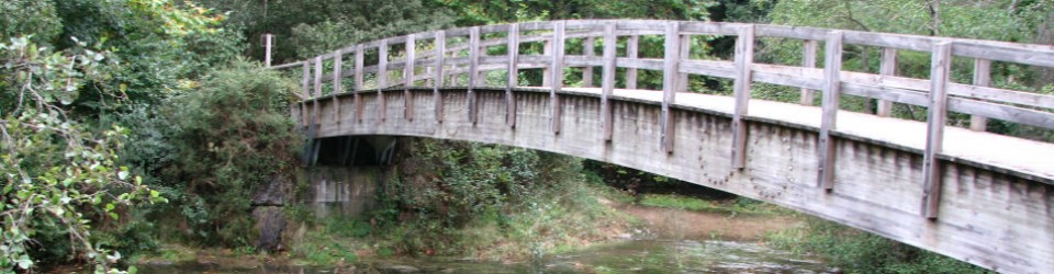
GR in Soria, a personal favorite
What? Is this some kind of code?
Sort of – though most Euro-hikers are already smiling. These cryptic letters are for the network of European walking trails: GR for Gran Recorrido (long distance), PR for Pequeño Recorrido (short distance) and SL for Senda Local (local trail).
This network of trails is mostly in France, Belgium, the Netherlands and Spain and the official trails are certified by the regional or national organization that manages walking and hiking in each country. The signage is the same in all countries, and some of the trails are international.
Theoretically these routes have few if any technical difficulties (no scrambling or extremely steep climbs) so they are accessible for almost everyone. Theoretically the routes access towns or other supply points frequently so there’s no need to carry huge amounts of food on long trails. And theoretically the signage is so easy to follow that walkers don’t need to worry about getting lost.
In practice, here in Spain the trails range from fabulously laid out and marvelously signed to anything but: challenging mountain trails suitable only for fit and experienced hikers, or virtually unmarked trails are not unusual in Spain.
Part of that problem is specifically Spanish: recreational walking is relatively new in Spain, while other European countries have been walking for fun for much longer. (The flip side of that: due to underdevelopment and relative isolation, many traditional footpaths and cart roads were in regular use in Spain until the 1960’s, so right-of-ways still in place and walking trails easy to re-create.)
Another possible issue: in Spain the walking trails are under the mountaineering federation, often more interested in high-adrenaline sports like technical climbing and peak-bagging, while in France there’s a specific federation for walking. Also, on long-distance trails different regional federations or organizations must coordinate marking trails, not always easy to manage.
And last but of course not least, part of the problem is money – it’s expensive to lay out and mark a trail, and sometimes there is no money left over to maintain signage once a trail is created.
But in spite of the issues, these trails are a wonderful option for walkers, a great way to discover rural Spain. Just do your research ahead of time, take maps and any additional information you can, and of course follow all the usual safety procedures for walking and hiking.
Read on to learn more
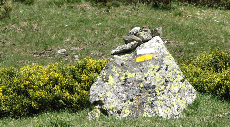
PR blaze in upper Manzanares valley (Madrid)
Where to go: see list at the end for information on these trails. There is a huge difference in the number of trails and how they’re managed between Spanish regions: Catalunya is where it all started (1974, no less) and they still have more trails and more fondness for walking than most regions. Most of Spain’s north has good trails, and there are some excellent trail systems in central Spain, most notably provinces of Soria, Burgos and Valladolid, possibly due to specific, forward-thinking individual or local development groups.
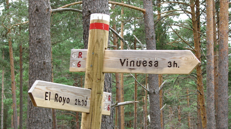
Signage: All three trails use the same kind of signage painted on trees, rocks or sometimes vertical signposts: two horizontal stripes, the top one white and underneath color for the trail system. Turnoffs or changes in direction should be signed with white right-angle marker next to the stripes, or by right-angling the stripes themselves. At crossroads, the wrong direction should be signed with an X, one arm white and the other arm the color for the trail system. Altogether this painted signage can be called flashes, waymarks or blazes.
GR / Gran Recorrido (long distance). Blazes: Red and white. Distance: usually over 50 kilometers (31 miles), though might be a little shorter if there are some challenging parts. Spain has more than 120 long distance trails: the longest is the GR7 from Andorra to Tarifa, 2,699 kilometers (1,677 miles), part of a trans-European trail that continues to Athens. The GR10 crosses northern Madrid on its way between Valencia and Lisbon; at 1,600 kilometers (994 miles) it’s one of the country’s longest. Other long trails follow the Ebro or Duero river, but most of the GR trails are 80 – 300 kilometers (50 – 186 miles) long.
PR / Pequeño Recorrido (short distance). Blazes: yellow and white. Distance: usually 10-50 kilometers (6-31 miles). Sometimes these routes are loops off the longer GR trails, sometimes traditional routes between villages and sometimes more hiking than walking. A quick look at the list of PR in Madrid (see below) was a bit of a shock: I know the mountains quite well and signage for some of the trails listed is not in place, or just barely. (eeek!)
SL/ Senda Local (local trail). Blazes: green and white. Distance: usually under 10 kilometers. This kind of trail is less frequent, probably because the requirements for certifying a short trail are more trouble than most local organizations can manage, when they have the option of creating their own trail system outside the European network.
More information
GR / Gran Recorrido (Long distance), list of trails sorted by number. Many have links for additional information, though initially no information on region, easy to find by clicking on link for trails. http://es.wikipedia.org/wiki/Gran_Recorrido
PR / Pequeño Recorrido (Short distance), list of trails sorted by region. Most trails do not have links for additional information, but knowing where trails are located you can find more on internet or at regional mountaineering federation. http://es.wikipedia.org/wiki/Peque%C3%B1o_Recorrido
More info, though irregular in quantity and quality: Google Federacion de Montaña together with the name of the province or region that interests you most.
Hiking safety, basic tips at www.apinderinspain.com Mouseover Travel Tips to find Hiking Smarts